Northwestern University Transportation Center Hosts ‘Smarter Cities/Smarter Mobility’
Experts provided snapshots April 24 of how pervasive sensors, wireless communications, and connected computing systems will shape the urban transportation experience
Worldwide, populations are shifting into cities, creating an urgent need for solutions in infrastructure, connectivity, greener energy platforms, and communication. From traffic monitoring to electric vehicle adoption and charging to more predictable and timely public transit, the wireless movement of real-time data, combined with mobile personal computers like smartphones and tablets, is poised to empower the urban traveler and supply chain participants while maximizing the efficiency of transport systems in densely built environments.
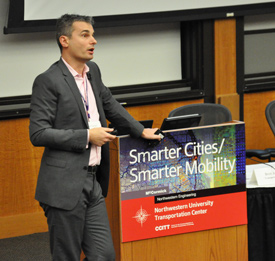
On April 24, transportation leaders and students discussed opportunities in sensor and wireless technologies at the Northwestern University Transportation Center’s Spring 2013 Industry Workshop, “Smarter Cities/Smarter Transportation.”
Designing a car for tomorrow’s cities is uniquely challenging, said speaker Chris Borroni-Bird, vice president of strategic development at Qualcomm USA — but the opportunities are enormous for creating a vehicle that is electric, wirelessly connected, and designed with the city-dweller and the environment in mind.
Borroni-Bird discussed the Qualcomm Halo, a system that can charge electric vehicles wirelessly when the car is parked over a charging pad. The technology — which is currently being tested in London — eliminates the hassle of cords and lessens trip hazards in public charging stations. Most importantly, it opens the possibility of “dynamic charging,” in which a car could charge itself by driving on roads installed with charging devices.
“Instead of carrying around a heavy battery, cars could charge while driving,” Barroni-Bird said. “It’s an elegant solution.”
Future cars could also see wireless connectivity enhanced to the point where vehicles could communicate with one another, bikers, pedestrians — even with stoplights, he said.
Amine Haoui, CEO of Sensys Networks, discussed his company’s development of small in-pavement wireless sensors to monitor traffic status and incidents on roadways. Implemented in cities from Chicago to Melbourne, Australia, the resilient, low-maintenance sensors detect vehicle types, traffic volume, speed, and unplanned incidents and relay the data to traffic management agencies and to motorists via installed, digital roadway signs.
 The systems enable motorists to avoid backups and make better travel choices, and also provide invaluable information to traffic professionals about bottlenecks, safety issues, and overall system behavior, so they can intervene and improve the efficient flow of vehicles and drivers. “Suddenly you have a full view of what’s going on,” Haoui said.
What about connecting entire cities? That is the goal of Hardik Bhatt, director of S+CC IoE Strategy and Global PPPs in the Industry Solutions Group at Cisco Systems. Through Cisco’s Smart+Connected Communities program, Bhatt works to transform physical communities into “connected communities,” using intelligent networking capabilities to bring together people, services, community assets, and information to help community leaders address challenges like traffic and carbon emissions.
When communities are virtually connected, residents can share resources, support efforts toward economic and environmental sustainability, and access government services and health care remotely. “Our thought is to bring services, as much as possible, into the Cloud, so management of a city becomes easier,” Bhatt said.
What will it take, from a technical standpoint, to accomplish these opportunities? That question was posed by Hani Mahmassani, William Patterson Distinguished Professor of Transportation at Northwestern and director of the Transportation Center.
Two types of data are required, he explained. Historical data — such as estimated travel times based on previous measurements of a certain time and route — is useful for creating benchmarks, Mahmassani said. But real-time data is vital for accuracy and to update predictions in case of traffic accidents, fires, or other incidents.
In a project that recently underwent testing in Salt Lake City, Mahmassani’s team explored using weather forecasts as a factor in traffic management. By using storm predictions to determine when to use traffic interventions, such as detours, the researchers could determine what level of intervention was needed to keep traffic moving at an optimal speed.
 With numerous agencies and thousands of schedules involved, making real-time travel predictions for public transportation is especially challenging. Brian Shapiro, vice president of smarter mobility at Veolia Transdev, explained how his company is working to develop the first multimodal prediction model in the United States to use real-time data. (While there are a number of trip planning applications available today, they rely solely on historical data, Shapiro said.)
The result would be a system that, with just an arrival time and the starting and ending points, could advise a user to choose the best route that might involve several modes of transportation — with up-to-the-minute detours based on traffic, road closures, or even a broken-down bus. Veolia Transdev’s model, made in collaboration with IBM’s Smarter Cities program, would send alerts via signs throughout the transit system and would send text messages to users’ smartphones if their commute is disrupted.
If developing a travel prediction model for transit in the United States is complicated, imagine doing it in a developing country. Ogi Redzic, vice president, Traffic & Automotive Cloud for Nokia Location & Commerce, discussed his company’s use of real-time sensor information for building knowledge around the globe.
Nokia, the owner of Nokia Traffic & Automotive (formerly NAVTEQ Traffic), offers traffic data services “in 33 countries and growing,” Redzic said. In India, where bus schedules and stops are unpublished and difficult for an outsider to comprehend, Nokia carefully collects weeks’ worth of historical data via GPS units to determine each bus’ route and schedule. The task of separating out the knowledge from the “noise” is daunting because buses pause for numerous reasons besides scheduled bus stops; traffic lights and pedestrians also require buses to come to a stop, and Nokia’s analysts must be able to differentiate. Using the GPS readings, Nokia has been able to tell with 90 percent accuracy where the real stops are, and then make these accurate schedules available.
“Smarter Cities/Smarter Mobility” was hosted by the Transportation Center, the McCormick School of Engineering and Applied Science, and the Center for the Commercialization of Innovative Transportation Technology.